Iriomote Island
Go trekking through forest primeval - without leaving Japan
Originally published on metropolis.co.jp on August 2008

Photo by Takuji Ikeda
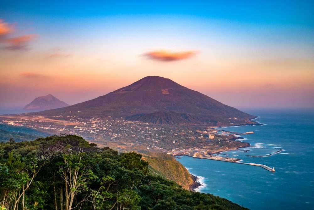
“Japan.” It hardly evokes mental images of lush, green jungles. Yet just off the radar of Western travelers is Iriomote Island, one of the country’s last areas of deserted wilderness. Although popular with domestic eco-tourists and lovers of water sports, this destination largely remains a secret among foreigners in Japan.
Iriomote is part of the Yaeyama chain, one cluster of the many islands that make up Okinawa. Edging close to the Tropic of Cancer, it lies roughly 2,000km southwest of Tokyo, and is 200km closer to Taiwan than to Naha. Although the island’s 289km2 make it the second largest in Okinawa Prefecture, Iriomote has only about 2,200 residents. The land is shared by an almost equal number of cows grazing on stretches of level ground near the coast.
The island’s only road runs along the coast from the west to the south, connecting nearly all of Iriomote’s villages along the way. Four-fifths of the land mass is covered in subtropical, primeval jungle and numerous small mountains, the highest of which is Mt Komi, at 470m above sea level. Most of the island comprises Iriomote National Park, which was established in 1972 and which is the southernmost protected nature reserve in Japan.
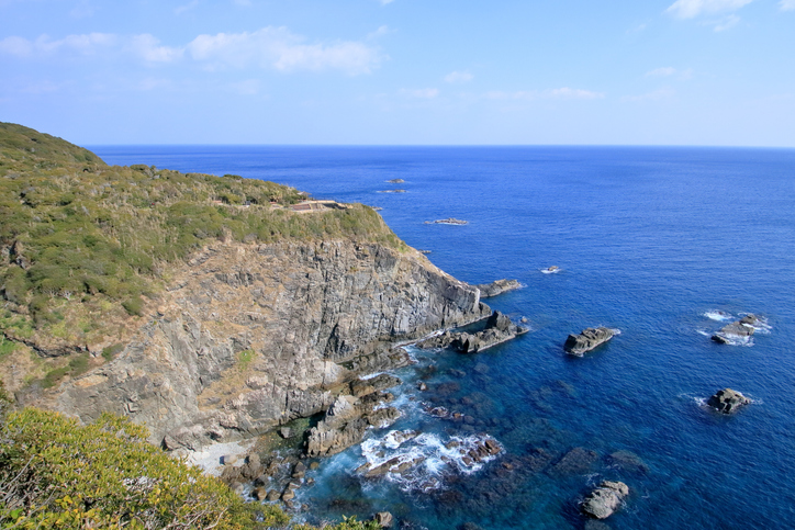
Iriomote’s reefs offer excellent snorkeling and diving opportunities. You can arrange lessons and rent gear at the dive shops dotted along the road in the villages. Hoshizuna Beach is one of many fantastic snorkeling spots, but its main attraction is the sand, which is actually tiny corals shaped like stars.
But pristine ivory coastline is hardly unique to Japan’s southern archipelago. What sets Iriomote apart is its interior, which boasts rivers flanked by mangroves, creeks crisscrossing the mountainous terrain, and majestic waterfalls, all covered in dense jungle vegetation.

Photo by Alena Eckelmann
There are several varieties of mangroves and ferns along the two main rivers, Urauchi-kawa and Nakama-kawa. Urauchi-kawa in particular gives the impression of a mini version of the Amazon, meandering its way through the jungle landscape for about 8km before it narrows down and becomes impassable by boats. Sightseeing craft carry day trippers upriver to Kanpire-no-take and Maryudo-no-take, two scenic waterfalls that are the highlight of a short and gentle hike starting at the boats’ landing point.
The real adventure, a cross-island trek, begins at the top of Kanpire-no-dake and finishes in Otomi village near Ohara in the south. The treacherous trail stretches some 21km and can take an entire day to conquer; it’s an excursion not to be taken lightly. Only two dozen signposts, starting at the top of the waterfalls, mark the route. They are sometimes difficult to make out, as nature has its way here. Landslides and false trails created by lost hikers make the narrow path confusing. The trek is a constant up-and-down over hilly terrain, and requires crossing countless creeks and several larger streams. As you maneuver across slippery rocks in the waterbed, leeches await the less-than-surefooted. Locals also warn about poisonous snakes known as habu.
But the adventure pays off, as hikers can see jungle vegetation like palms, ferns and lianas up close. The island is also home to the Iriomote mountain cat, or yamaneko, which is much talked about but rarely seen.
At dusk you should be out of the thicket and onto the forest road, which starts where the trail ends at signpost #24. This path is, apparently, all that remains of a plan to build a paved road across the island. Walking the final 7km stretch in darkness, the white pebble stones of the road leading the way, you’ll feel relief after the adventures of the jungle. The eerie quietness is broken only by the occasional bird chirping somewhere at roadside. Then, suddenly, a dramatic spectacle unfolds as tens of thousands of fireflies appear and punctuate the darkness of the night with their tiny lights.
After the hike you can have a soak at Painu Maya Resort, Japan’s southernmost hot spring. It offers indoor and outdoor baths, steam saunas, an outdoor pool and a large relaxation area with massage services to soothe those tired legs.
Iriomote does not have an airport, so you’ll need to fly to neighboring Ishigaki either directly, or via Naha. From the airport take a shuttle bus to Ishigaki Terminal, which is the departure point for ferries to Iriomote, some 20km west. High-speed ferries are run by Yaeyama Kanko and Anei Kanko to Uehara and Ohara (about 40min, ¥2,000 round-trip). They operate frequently between 7am and 5pm. River cruises on the Urauchi-kawa run 9am-4pm daily (¥1,500). The villages of Uehara and Urauchi in the north and Ohara in the south offer a range of accommodations and souvenir shops. There are some small food stalls, but no major convenience stores have invaded this peaceful island—yet. Restaurants are sparse and it is best to arrange to eat where you stay. The best seasons for the hike are autumn (September and October), if there is no typhoon, and spring (March to early May). Anyone attempting the hike across the island is advised to go with a partner or group, get local advice, and be prepared to camp. Hikers must register in person with the local police, who can provide a useful area map. More information, such as campsites and rental car companies, can be found on the tourism board’s English website (http://tinyurl.com/iriomote).

Photo by Alena Eckelmann